If you are a homeowner, you know that property surveys are completed to establish and validate land boundaries. This includes the plot of land a home sits on, as well as any below-the-surface improvements such as a well or a septic tank. Surveys also identify other conditions or possible restrictions that deal with the legal description of a property like encroachments (unauthorized use of a neighbor’s property) or easements (agreed upon, shared use). Think of examples like fences, hedges, treelines, driveways, or structural additions that may cross legal land boundaries.
Nearly all property surveys begin with an examination of the legal descriptions of the land they’ll be surveying and its history. Surveyors will then actually physically go out to the property and blueprint out the land, its boundaries, and different elements that make up the property.
These surveys provide an accurate, exact measurement of property lines in an area. Boundary surveys are generally used to settle a legal dispute over land, locate easements, or for your personal records. Mortgage lenders or title companies almost always require a property survey in order to complete a real estate transaction. They provide an element of awareness and clarity about what is being sold and any existing rules or requirements.
According to Baseline Equipment Company, “Since the 1980s, electronic distance measurement (EDM) devices have become the standard for land survey measurements. These devices allow surveyors to measure distances more efficiently and more accurately than with a survey tape measure. In addition to measuring distance, land surveyors also identify and measure property lines. The first step in the process is to obtain the initial property survey from county municipalities.”
However, in 2023 drones and aerial footage are becoming more of an industry standard for surveying than ever before. Not only does a drone provide more efficiency and accuracy for land surveys, but also there are several other benefits that this method of obtaining footage can provide homeowners when it comes to showcasing their property.
While your property survey is used primarily for legal reasons, similar aerial footage has several benefits when it comes to selling your home. Below are three ways drones and aerial footage of your home may be used along with your home survey to leverage your home’s best angle.
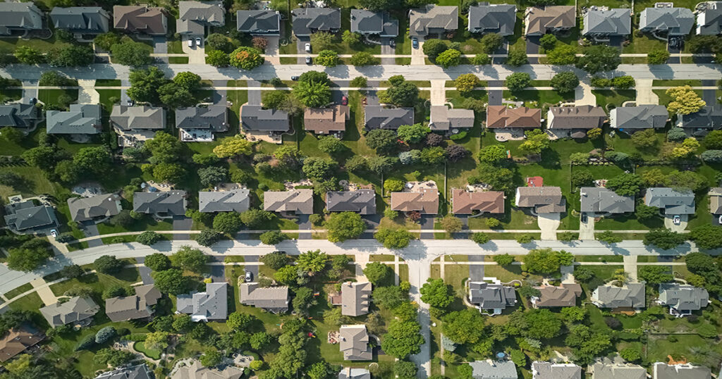
- Aerial videography and photography tend to show scale and distance better than standard photography
When it comes to selling your home, why not ensure that you have the most accurate and best quality footage available? When potential buyers are researching for a purchase, aerial footage of your home’s property line, surrounding geography, bodies of water, other roads and homes, as well as landmarks surrounding the area simply cannot be seen from a basic photograph. Buyers love being able to judge proximity.
- Sell your home faster with aerial footage
HomeJab reports “According to MLS research, properties with aerial photography sell about 68% faster than homes using standard photographs. Most importantly, drone costs have decreased significantly, and most experienced professional real estate photographers provide aerial imaging services.”
- Angles, angles, angles
Finally, one of the greatest advantages of using aerial photography is that they provide a variety of vantage points of the home and property. Whether the shots are taken from the roof, chimney, front or back elevation, or even from the ground, the angles a drone can provide are endless. As more and more home buyers begin their real estate searches online, having the absolute highest quality imagery of the property possible may have your home’s first impression floating among the clouds!